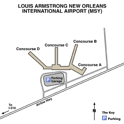
Louis Armstrong New Orleans International Airport Maps and Directions
New Orleans Maps and Directions
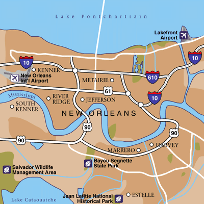
New Orleans Area Map
Maps and Directions
New Orleans International Airport (MSY) is located approximately 11 miles from the central business district (Riverwalk, French Quarter and Jackson Square) of New Orleans. Interstate 10 East, Interstate 55 South and Interstate 65 Southwest lead to New Orleans International Airport (MSY).
Featured Hotels